Understanding Los Angeles Zoning Maps (2025 Guide)
Los Angeles is one of the most complex real estate markets in the country. At the center of it is zoning. Every property has a zoning code. That code decides what you can build, how tall it can be, and even how much parking is required.
Table of Contents
ToggleFor a homeowner, zoning may affect adding an ADU or splitting a lot. For developers, it sets the rules for apartments, offices, or mixed-use projects. For investors, it shapes the potential value of a property.
The problem is that Los Angeles zoning laws are dense and hard to read. Zoning maps make them easier. They use colors and labels to show what’s allowed in each area. With the right maps, you can see where the city plans growth and where restrictions apply.
At JDJ Consulting Group, we help clients read these maps and apply them to their projects. We guide homeowners, developers, and investors through zoning codes, entitlements, and permits. This guide explains Los Angeles zoning in five key maps that matter most.

What Are Zoning Maps and Why They Matter in Los Angeles
A zoning map is not just a diagram. It is the city’s visual plan for land use. Each color and symbol shows what type of development is allowed.
Zoning maps control many parts of a project:
Density – how many units or businesses can go on a lot.
Height – how tall a building can be.
Parking – how many spaces a project must provide.
Use – whether land is for homes, shops, offices, or factories.
This is why zoning maps are so important. For example, an R1 zone only allows single-family homes. An R3 zone, by contrast, allows multifamily apartments. Confusing the two could waste months and money.
Zoning maps also connect to Los Angeles’s growth strategy. Areas near bus and rail lines often have incentives for more housing. Historic districts or hillside neighborhoods may face strict limits. Knowing these details helps property owners avoid delays and plan smarter.
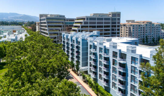
The Los Angeles General Plan Zoning Map
The General Plan Zoning Map is the big picture. It shows how land is organized across the entire city. It divides Los Angeles into residential, commercial, industrial, and mixed-use areas.
The map is color-coded. Large parts of the city are shaded for low-density homes. Busy streets like Ventura Boulevard or Wilshire are marked for shops, offices, and taller buildings. Industrial districts such as Vernon and parts of Downtown appear in darker tones.
This map is where most developers start. If you’re buying land in West LA, the General Plan tells you if the city wants that area to stay residential or shift toward denser use.
At JDJ Consulting Group, we always check the General Plan first. It helps us align projects with city policy. When your project fits the map’s vision, the approval process is smoother and faster.
Residential Zoning Maps (R1, R2, R3, R4)
Residential zoning maps show where housing of different sizes can be built. These zones are labeled R1, R2, R3, and R4. Each one sets clear rules about what type of homes are allowed.
R1 – Single-family homes. This is the most common zone in Los Angeles.
R2 – Duplexes. Two units can be built on one lot.
R3 – Low-rise apartments or condos. Allows more density than R2.
R4 – Higher-density apartments and condos. Often near transit or busy corridors.
These categories decide more than just the number of units. They also set rules for building size, yard space, and parking. For example, an R1 lot may have strict setback rules to keep houses spaced apart. An R3 lot may allow taller structures and smaller yards.
Recent state laws have added more flexibility. SB 9 lets some owners split single-family lots and build duplexes. ADU laws also allow homeowners to add accessory units in many residential zones. These changes give families and small investors new opportunities.
Here’s an example. A homeowner in Highland Park with an R1 lot may now build a duplex or add an ADU. A developer in Koreatown with an R3 parcel can plan a mid-size apartment building instead of single-family homes.
At JDJ Consulting Group, we help clients see the full potential of residential zoning. We guide homeowners through ADU permits, investors through lot splits, and developers through multifamily entitlements.
Map 1: Residential vs. Commercial Zones
LA divides space between residential 🏠 and commercial 🏢 zones. Understanding these boundaries is the foundation of any project.
- 65% of LA land is zoned residential.
- 22% is commercial or mixed-use.
- 13% falls under industrial and other uses.
Commercial & Mixed-Use Zoning Maps (C and CM Zones)
Commercial zoning maps show where businesses, offices, and shops can operate. In Los Angeles, these zones are labeled C1, C2, C4, and so on. Each type allows different levels of activity and building size.
C1 – Small shops and neighborhood services, such as cafes or dry cleaners.
C2 – General commercial use, including offices, stores, and mid-size retail.
C4 – Larger commercial uses like shopping centers or mixed-use projects.
Many commercial zones also allow mixed-use development. This means housing can be built above ground-floor retail or office space. These projects are common near major boulevards and transit lines.
Transit Oriented Communities (TOC) add another layer. If a property is near a Metro station or major bus line, developers may qualify for bonuses. These include taller buildings, more units, or reduced parking requirements.
For example, a developer in Hollywood with a C4 lot could build apartments above retail space. If the site qualifies for TOC, the project might add even more housing units than the base zoning allows.
Commercial and mixed-use zones are valuable because they meet two needs at once: housing and business space. They also bring higher returns for investors. But they come with more complex entitlement rules and stricter design reviews.
At JDJ Consulting Group, we help clients unlock the full potential of these zones. We guide developers through TOC programs, density bonuses, and permitting so projects move forward without costly setbacks.
Industrial Zoning Maps (M1, M2, M3)
Industrial zoning maps show where manufacturing, storage, and heavy commercial uses are allowed. These zones are marked M1, M2, and M3. Each zone permits different types of industrial activity.
M1 – Light manufacturing. This includes small factories, auto repair, or local warehouses.
M2 – Heavier industrial use. Larger warehouses, logistics hubs, and distribution centers fit here.
M3 – Heavy industrial. This is for large-scale factories, plants, or operations that may create noise or pollution.
Industrial zones cover large parts of Los Angeles, especially near the ports, rail lines, and older warehouse districts. But these areas are changing. Many former factories in Downtown and the Arts District have turned into offices, studios, and creative spaces. This process is called adaptive reuse.
For example, a warehouse in the Arts District might now house a tech company, brewery, or art gallery. These conversions can bring higher value, but they also face strict zoning rules. Noise limits, parking requirements, and environmental reviews can slow projects down.
Industrial zoning offers both challenges and opportunities. On one hand, it restricts housing and retail. On the other, it creates space for logistics, e-commerce, and creative industries. Knowing the limits of each industrial zone is key before buying or converting a property.
At JDJ Consulting Group, we advise clients on both traditional industrial projects and adaptive reuse conversions. We help navigate permits, zoning restrictions, and entitlement hurdles so developers can move forward with confidence.
Los Angeles Land Use Breakdown
🏠 Residential: 65% | 🏢 Commercial: 22% | 🏭 Industrial: 13%
Source: LA City Planning Dept (General Plan Land Use Data)
Height and Density Rules in Los Angeles Zoning
Height and density are two of the most important zoning rules in Los Angeles. They decide how tall a building can be and how many units can fit on a lot.
Height limits control the maximum number of stories or feet allowed. In low-density areas, this may mean only two stories. In high-density or commercial areas, buildings may rise much higher.
Density rules control how many homes or apartments can be built per parcel. This is often linked to the zone label, like R1 for single-family or R3 for multifamily.
Developers also look at FAR (floor area ratio). FAR compares building size to lot size. A higher FAR means you can build more floor space on the same piece of land.
For example, a parcel in Westwood zoned R3 may allow three to four stories with several units. A nearby C4 parcel could allow a taller mixed-use building with more apartments and ground-floor retail.
At JDJ Consulting Group, we help clients calculate height, density, and FAR early. This makes projects realistic from the start and avoids delays during entitlement review.
Map 2: Height & Density Rules
Building heights and unit counts vary across the city. Some zones allow towers, while others restrict to small homes.
- Downtown: up to 50+ stories 🏙️
- Neighborhood zones: 1–3 stories 🏡
- Transit corridors: higher density approved 🚆
Height Restrictions by Zone in Los Angeles
Neighborhoods
(1–3 stories)
Transit Corridors
(10–15 stories)
Downtown LA
(50+ stories)
Source: Los Angeles Zoning Code (LAMC Section 12.21)
Transit-Oriented Development and Zoning Incentives
Los Angeles has invested heavily in transit, and zoning has followed. Properties near Metro rail lines and major bus corridors often qualify for Transit Oriented Communities (TOC) incentives. These programs encourage housing near transit to reduce traffic and improve access.
TOC benefits can include:
Extra height for taller buildings.
More units than the base zoning allows.
Reduced parking requirements.
For example, a lot near a Metro station in Koreatown may qualify for TOC Tier 4. This could allow a developer to build more than double the units compared to a non-transit parcel.
These incentives are powerful, but the rules are detailed. Developers must meet requirements for affordable housing, design, and location.
At JDJ Consulting Group, we help clients unlock TOC bonuses while staying in compliance. We align projects with transit incentives so they gain more density and value without facing permit denials.
Map 3: Transit-Oriented Development Zones
Housing near metro lines and bus corridors is designed for density. These TOD zones make urban growth more sustainable.
- 90+ TOD areas citywide 🚇
- Within ½ mile of major transit hubs 🚌
- 30% more units allowed in TOD zones
Transit-Oriented Development (TOD) Elements
Metro
Bus Lines
Mixed-Use
Housing
Source: Metro Transit-Oriented Development Program, LA Metro 2024
Historic and Protected Areas in Los Angeles Zoning
Not every area of Los Angeles is open to growth. Some neighborhoods have extra protections. These are called overlay zones or specific plans.
One example is the Historic Preservation Overlay Zone (HPOZ). It protects neighborhoods with historic homes. Projects in these zones must match the area’s style and character. Changes are reviewed by preservation boards before approval.
Other overlays protect sensitive areas like hillside zones, coastal areas, or fire-prone districts such as Pacific Palisades. These rules may limit height, require larger setbacks, or block certain types of development.
For example, a developer in an HPOZ in West Adams may not be allowed to replace a historic duplex with a modern apartment building. Instead, they may need to restore the existing structure.
At JDJ Consulting Group, we guide clients through these layers of zoning. We balance project goals with local protections so developments can succeed while respecting community rules.
Map 4: Historic Preservation & Protected Areas
LA protects its cultural identity by limiting development in historic districts and natural zones.
- 35+ Historic Preservation Overlay Zones (HPOZ) 🏛️
- 15% of city land under environmental protections 🌳
- Renovations require special approvals in these areas
Protected & Historic Areas in Los Angeles
LA has 35+ Historic Preservation Overlay Zones (HPOZ) that limit redevelopment and protect cultural identity.
Source: Office of Historic Resources, City of Los Angeles
Overlay Zones and Specific Plan Maps
Overlay zones and specific plans add extra rules on top of standard zoning. They guide development in special areas and ensure projects fit local goals. Unlike base zones, overlays can limit or expand what’s allowed.
Examples of overlay zones:
Historic Preservation Overlay Zones (HPOZs): Protect neighborhoods with historic architecture. Renovations must match the original style.
Community Plan Implementation Overlays (CPIOs): Apply rules that reflect a community’s vision for growth.
Special or Specific Plans: Focused plans for areas like Hollywood, DTLA, or fire-prone hillside neighborhoods. These plans set unique height, density, and design rules.
Overlays affect many aspects of a project: building design, unit count, setbacks, and landscaping. Some overlays also provide incentives, like extra units or flexible parking requirements, if developers meet certain criteria.
For example, a developer in a CPIO zone may be allowed a larger building footprint if the design preserves open space and community character. In an HPOZ, a historic home may only be altered with careful review and approvals.
At JDJ Consulting Group, we guide clients through overlay rules and specific plans. By interpreting these complex layers early, we help developers, investors, and homeowners make informed decisions. This avoids costly revisions or permit delays and ensures projects comply with both citywide and neighborhood-specific regulations.
Map 5: Upcoming Zoning Changes
LA’s zoning code is evolving. New updates will decide where development can grow in the next decade.
- Proposed 2026 update: +15% density in growth corridors 🏗️
- ADU expansion: more flexible backyard housing rules
- Green zoning: sustainability bonuses for eco-friendly projects 🌱
How Zoning Maps Impact Development Decisions in Los Angeles
Zoning maps do more than show property lines. They shape every major decision in real estate development. Knowing the rules early can save time, money, and headaches.
Key Impacts:
Project Type – Maps determine whether a lot can host single-family homes, apartments, offices, or mixed-use buildings.
Size and Height – Zoning sets limits on stories, floor area, and building footprint. Developers must match these rules to avoid permit denials.
Density and Units – Maps dictate how many units or square feet can be built. Higher-density areas allow more housing or commercial space.
Neighborhood Fit – Overlay zones and specific plans ensure projects align with community character, historic preservation rules, and safety regulations.
Financial Planning – Zoning affects project costs, including parking requirements, environmental compliance, and entitlement fees.
Example:
An investor comparing two parcels in Koreatown may see that one R3 lot allows a mid-rise apartment building, while a nearby R1 lot only allows a single-family home. Without understanding zoning, they might overpay or design an infeasible project.
Upcoming Zoning Code Updates in LA
2025
Zoning Review Process
2026
Density Bonus Updates
2027
Green Zoning Standards
Source: LA City Planning – Zoning Code Rewrite Project
How to Access Los Angeles Zoning Maps Online
Los Angeles provides several tools to check zoning maps online. These resources make it easier to see what rules apply to a property before buying or developing.
Main Tools:
ZIMAS (Zoning Information and Map Access System)
ZIMAS is the city’s official interactive map.
You can search by address, parcel number, or neighborhood.
It shows zoning, overlay zones, height limits, and parcel details.
Example: A developer can check a lot in Downtown LA to see if it qualifies for mixed-use development or TOC incentives.
Los Angeles Planning Department Interactive Maps
These maps include General Plan, community plans, and specific plan overlays.
Users can toggle layers to see residential, commercial, and industrial zones.
Helpful for understanding restrictions in historic or hillside neighborhoods.
County GIS Tools
Los Angeles County provides GIS data for parcels outside city limits.
Shows land use, zoning designation, and surrounding property details.
Tips for Using Online Maps:
Always cross-check zoning with city planning documents, as maps may not reflect recent updates or entitlements.
Look for overlays or specific plans, which can add extra rules.
Take notes on height, density, and allowed uses before designing a project.
Why Work with a Zoning Consultant in Los Angeles
Navigating Los Angeles zoning laws can be challenging. With so many maps, overlays, and city regulations, even small mistakes can cause delays or extra costs. This is where a zoning consultant adds real value.
Key Benefits of Working with a Consultant:
Expert Guidance – Consultants interpret zoning maps, overlay rules, and specific plans accurately.
Entitlement Strategy – They help plan projects to meet city regulations and maximize allowable density and height.
Permit Navigation – Consultants streamline the permitting process, reducing delays and rework.
Site Selection & Feasibility – They identify parcels with the highest potential based on zoning, overlays, and incentives.
Problem Avoidance – Avoid costly mistakes with zoning restrictions, community rules, or historic protections.
At JDJ Consulting Group, we provide end-to-end solutions for homeowners, developers, and investors. We combine zoning expertise with entitlement planning and permit expediting. From interpreting maps to securing approvals, we ensure projects move forward efficiently and successfully.
If you’re planning a project in Los Angeles, working with a knowledgeable zoning consultant is critical. Contact JDJ Consulting Group today to see how we can help you navigate LA zoning maps, maximize project potential, and reduce risk.
Schedule your free consultation today at: https://staging.jdj-consulting.com/contact-us/
FAQs: Los Angeles Zoning Maps
1. What is zoning in Los Angeles?
Zoning in Los Angeles refers to the city’s rules that control how land can be used. These rules decide whether a property can be used for homes, businesses, or industrial purposes. Zoning also determines the size of buildings, the number of units allowed, and parking requirements. Understanding zoning is essential for homeowners, developers, and investors, as it directly affects what you can build and how projects are approved.
2. How can I find the zoning for a property in Los Angeles?
To find zoning information for a property, you can use the city’s online zoning map tools by entering the address or parcel number. These maps provide detailed information about the property’s zoning designation, permitted uses, overlay zones, and restrictions. Knowing the zoning beforehand helps in planning construction projects, assessing development potential, and avoiding costly mistakes.
3. What do zoning codes like R1, C2, and M3 mean?
Zoning codes in Los Angeles categorize land into specific uses:
R1: Single-family residential, typically limiting lots to one home.
C2: General commercial, allowing businesses, offices, and retail.
M3: Heavy industrial, for factories, warehouses, or large-scale production.
Each code also includes rules about building height, number of units, setbacks, and floor area. Understanding these codes ensures that your project complies with city regulations and avoids permit delays.
4. What is the Zoning Information and Map Access System (ZIMAS)?
ZIMAS is an interactive online tool that provides detailed zoning information for any property in Los Angeles. It shows the property’s base zone, overlay zones, parcel size, permitted uses, and height and density limits. ZIMAS is essential for developers, investors, and homeowners who want to understand a property’s potential before purchasing or designing a project.
5. How do I determine the zoning regulations for a property?
Zoning regulations are determined by reviewing a property’s base zone and any applicable overlays or specific plans. Using city maps and zoning codes, you can see what types of buildings are allowed, the maximum height and density, setback requirements, parking rules, and special restrictions. Determining zoning early in the planning process is critical for project feasibility and helps prevent delays or legal issues.
6. What is a Specific Plan in Los Angeles zoning?
A Specific Plan is a detailed guide for development in a particular area of the city. It can modify standard zoning rules to address unique community needs, including building design, height, density, and land use. Specific Plans often aim to preserve the character of neighborhoods, guide commercial corridors, or promote redevelopment in targeted districts. For developers, understanding these plans is key to meeting city requirements and maximizing project potential.
7. What are Overlay Zones in Los Angeles?
Overlay Zones add additional regulations on top of base zoning rules. They are used to address specific local concerns, such as historic preservation, environmental protection, or neighborhood character. Overlay zones may limit building height, require architectural reviews, or provide incentives for certain types of development. Developers must consider overlays to ensure projects comply with all layers of zoning regulations.
8. How do zoning regulations affect property development?
Zoning regulations determine almost every aspect of property development, including what can be built, where it can be built, and how it must be designed. They impact project size, height, density, parking, and overall feasibility. Developers who ignore zoning rules risk project delays, fines, or denied permits. Understanding zoning also helps in strategic decisions, such as whether to pursue residential, commercial, or mixed-use development.
9. What is the role of the Department of City Planning in zoning?
The Department of City Planning oversees all zoning in Los Angeles. It implements zoning codes, reviews development applications, and ensures projects comply with city policies. The department also guides the public on land use regulations and updates zoning maps and codes to reflect changing community needs. Developers and homeowners often work closely with this department to secure approvals and permits efficiently.
10. Can zoning regulations change over time?
Yes, zoning regulations can change through rezoning, adoption of specific plans, or amendments to the zoning code. Changes may occur to support growth, preserve neighborhoods, or adapt to market demands. Public hearings and city council approval are usually required. Staying informed about zoning updates is essential for investors and developers to avoid unexpected restrictions or opportunities.
11. What is a Nonconforming Use in zoning?
A Nonconforming Use exists when a property or structure legally predates current zoning rules but no longer meets the current regulations. Nonconforming uses are often allowed to continue but cannot be expanded or significantly altered without city approval. Understanding nonconforming use is critical for developers planning renovations or expansions in older neighborhoods.
12. How can I appeal a zoning decision?
If a zoning decision limits your project, you can file an appeal with the city planning authorities. Appeals may go to the Planning Commission or Board of Building and Safety Commissioners. During the appeal, you can request modifications, seek exceptions, or present evidence to support your project. A well-prepared appeal can result in approvals that comply with both zoning rules and development goals.
13. What is a Conditional Use Permit (CUP)?
A Conditional Use Permit is required for uses that may be allowed in a zone but need additional review to ensure they do not negatively impact the community. Examples include bars, schools, or large commercial facilities. CUPs provide a framework for the city to regulate special uses while allowing flexibility. Obtaining a CUP often involves public hearings and compliance with specific conditions.
14. What is the Floor Area Ratio (FAR)?
The Floor Area Ratio measures the total building floor area compared to the lot size. A higher FAR allows larger buildings relative to the land, while a lower FAR limits building bulk. FAR is a key factor in determining project density and helps maintain neighborhood character. Developers must calculate FAR carefully to ensure their project complies with zoning and maximizes usable space.
15. Why is understanding zoning important for property owners?
Understanding zoning helps property owners plan projects that are legal, feasible, and profitable. It reduces the risk of delays, fines, or redesigns and helps make strategic decisions about property use. Knowing zoning also allows owners to leverage incentives like Transit Oriented Communities, bonus density, or overlays that can enhance project value.
16. What is the Zone Information and Map Access System in Los Angeles?
The Zone Information and Map Access System (ZIMAS) is the City of Los Angeles’ official online platform for accessing detailed zoning information. It provides property-specific data, including zoning designations, land use, community plan area, building height limits, overlays, and planning applications. ZIMAS helps homeowners, developers, and investors make informed decisions before buying, designing, or developing properties.
17. How do Community Plan Areas influence development in Los Angeles?
Community Plan Areas (CPAs) are sections of the city with customized land use policies and zoning rules. Each CPA reflects the unique needs and vision of its neighborhood. These plans guide decisions on residential density, commercial development, historic preservation, and open spaces. Developers and property owners must align projects with CPA requirements to gain approvals and maximize project potential.
18. What are zoning reports, and why are they important?
Zoning reports provide a comprehensive overview of a property’s zoning designation, permitted land uses, overlays, development controls, and applicable community plans. These reports are essential for assessing property feasibility, planning new construction, or evaluating investment opportunities. Accurate zoning reports reduce the risk of noncompliance and costly delays.
19. What is the Los Angeles Zoning Code, and how does it affect land use?
The Zoning Code is the legal framework that defines allowable uses for land and buildings. It specifies residential, commercial, industrial, and mixed-use zones, along with building height, density, setbacks, and parking requirements. Understanding the Zoning Code ensures that projects comply with city rules and align with long-term planning objectives.
20. How do GIS web mapping applications support zoning research?
GIS web mapping applications provide interactive tools to analyze zoning data spatially. They allow users to view zoning areas, overlays, community plan boundaries, and development controls in a visual format. These tools are valuable for property research, development planning, and land use decision-making.
21. What is a Historic Overlay Preservation Zone, and how does it impact property development?
A Historic Overlay Preservation Zone (HPOZ) protects neighborhoods or structures with historic, architectural, or cultural significance. Properties within HPOZs must meet strict design standards and review processes for alterations, additions, or new construction. This ensures that new developments respect the character and heritage of the community.
22. How do building height controls affect development in Los Angeles?
Building height controls regulate the maximum vertical dimensions of structures based on zoning and overlays. These rules prevent oversized buildings from overwhelming neighborhoods, protect views and sunlight, and maintain consistent streetscapes. Developers must design projects that comply with height restrictions to avoid permitting issues.