Radius maps are useful for several reasons:
Identify stakeholders: See who should get project notices.
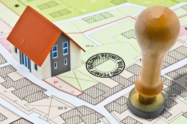
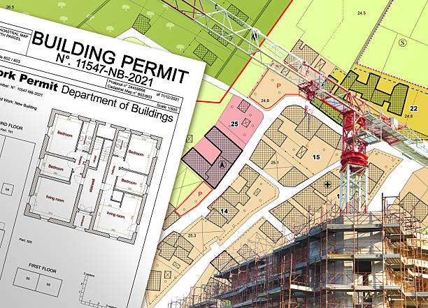
Ensure compliance: Meet city and county planning rules.
Increase transparency: Let the community clearly see the affected area.
Table 1: Common Radius Distances Used in Planning Applications
| Radius Distance | Typical Use | Legal Reference |
|---|---|---|
| 300 ft | Minor zoning changes | Los Angeles Municipal Code Sec. 12.37 |
| 500 ft | Conditional use permits | Residential and commercial projects |
| 660 ft | Environmental notices | CEQA compliance for bigger projects |
JDJ Consulting Group uses advanced mapping tools. We make sure each radius is precise and meets local rules.
Understanding Mailing Labels
After the radius map, you need mailing labels. Mailing labels have names and addresses of affected property owners and residents. They are used to send notices about hearings, zoning changes, or permits.
Important points about mailing labels:
Accuracy is key: Wrong addresses can delay your project.
Follow legal rules: Labels must meet city and county standards.
Save time: Labels make notifications organized and fast.
Table 2: Mailing Label Requirements for Planning Notifications
| Element | Description | Notes |
|---|---|---|
| Name | Property owner or occupant | Verify with assessor records |
| Address | Full mailing address | Include unit or lot number |
| Notice Type | Hearing, variance, or permit update | Must follow local rules |
| Delivery | Mail, certified, or hand-delivered | Depends on jurisdiction |
At JDJ Consulting Group, we create both radius maps and verified mailing labels. This ensures notifications are correct, professional, and reach the right people.
Why Radius Maps and Mailing Labels Matter
Radius maps and mailing labels work together. They help you:
Follow the law: Notify everyone within the required distance.
Avoid delays: Errors in maps or labels can slow your project.
Build trust: Clear notices help the community understand and respond.
JDJ Consulting Group combines precise maps with accurate mailing labels. This saves time and reduces risk.
Legal and Regulatory Framework
Understanding the rules is key for any planning project. Cities and counties have clear requirements for notifying property owners and residents. Missing these rules can delay your project or cause legal problems. JDJ Consulting Group helps you navigate these rules easily. We make sure your radius maps and mailing labels meet all local and state regulations.
Local Government Requirements
Each city or county may have different rules. Local laws decide:
How far the notification radius should reach
Who should be notified (owners, tenants, or both)
How notices must be delivered
For example, in Los Angeles:
Minor zoning changes often require a 300-foot radius notification.
Larger developments or conditional use permits may need a 500-foot or 660-foot radius.
Bullet Points: Local Notification Essentials
Verify property ownership through city or county records
Prepare mailing labels with complete addresses
Submit notices before the city’s deadline
Keep proof of notification for compliance
JDJ Consulting Group has local knowledge. We know Los Angeles city rules, deadlines, and requirements. This prevents mistakes and keeps your project moving.
State and Federal Guidelines
Some rules come from the state or even federal level. They usually apply to large projects or those with environmental impacts. For instance:
California Environmental Quality Act (CEQA): Requires notifications for projects with environmental impacts.
Statewide zoning rules: Can affect radius distances and notification formats
Following these rules ensures your project avoids fines or legal challenges. JDJ Consulting Group keeps up-to-date with all state and federal changes. We guide clients through compliance so your project stays on track.
Smooth Transitions Example
After understanding the legal rules, the next step is creating radius maps and mailing labels correctly. Following the guidelines ensures your notifications are accepted and your project avoids delays.
The Process of Creating Radius Maps and Mailing Labels
Creating accurate radius maps and mailing labels is crucial for every planning application. A clear process ensures compliance and saves time. JDJ Consulting Group uses proven methods to make this step simple and reliable.

Data Collection
The first step is gathering property information. This includes:
Property owner names
Occupants (if different from the owner)
Full mailing addresses
Accurate data is the foundation of both radius maps and mailing labels. Errors here can cause delays or rejected notifications. JDJ Consulting Group verifies every record before moving to the next step.
Mapping and Label Generation
Once the data is collected, we create the radius map. This shows all affected properties around your project site. Key points:
Maps are drawn to the exact radius required by law
Each property inside the radius is identified
Labels are generated directly from verified property data
Table 3: Steps to Generate Radius Maps and Labels
| Step | Action | Purpose |
|---|---|---|
| 1 | Gather property data | Ensure accurate mailing lists |
| 2 | Verify addresses and ownership | Avoid errors in notification |
| 3 | Draw radius map using GIS | Show affected properties clearly |
| 4 | Generate mailing labels | Prepare for official notifications |
| 5 | Review and verify | Maintain compliance and accuracy |
JDJ Consulting Group uses advanced GIS and mapping tools. This ensures precision and smooth workflow from start to finish.
Quality Assurance
Before sending notifications, quality checks are essential. This includes:
Double-checking property addresses
Confirming all required owners are included
Ensuring radius distances match local law
Reviewing mailing labels for formatting and legibility
A thorough quality check prevents mistakes and keeps projects moving without delays. JDJ Consulting Group handles this step carefully for every client.
Tips for Smooth Mapping and Mailing
Start early: Don’t wait until the last minute to gather data.
Keep records: Save all maps, labels, and notices for compliance.
Use verified tools: GIS and mapping software reduce errors.
Communicate with the city: Confirm requirements to avoid surprises.
Best Practices for Effective Public Notification
Notifying property owners and residents correctly is essential for any planning application. Proper notification avoids delays, ensures compliance, and builds trust with the community. JDJ Consulting Group follows clear best practices to make this process simple and effective.
Timeliness and Accuracy
Notifications must be sent on time and to the correct recipients. Missing deadlines or sending notices to wrong addresses can slow your project. Key steps include:
Plan early: Start preparing maps and labels as soon as the project begins.
Double-check data: Verify all addresses and ownership records.
Meet deadlines: Submit notifications according to city or county rules.
Short, clear notices sent promptly help the project move smoothly and reduce the risk of legal issues.
Clear Communication
Notices should be easy to read and understand. Include key details like:
Project description
Location and address
Date, time, and place of public hearings
Contact information for questions
Bullet Points: Tips for Clear Notices
Use simple language, avoid technical jargon
Highlight important dates and actions
Provide a map or diagram if possible
Make sure all required information is included
Clear communication helps residents understand your project. It also encourages participation and reduces confusion.
Community Engagement
Public notification is more than a legal requirement. It’s a chance to involve the community.
Encourage attendance at hearings: Well-prepared notices help residents feel informed and welcome.
Collect feedback: Listen to concerns and questions to improve your project.
Show transparency: Open communication builds trust and supports smoother approvals.
JDJ Consulting Group helps clients not only notify stakeholders but also engage them effectively. This approach improves outcomes and strengthens community relations.
Summary Table: Best Practices Checklist
| Step | Purpose | JDJ Consulting Role |
|---|---|---|
| Prepare maps and labels early | Avoid last-minute delays | Data verification and preparation |
| Verify addresses | Ensure all stakeholders are notified | Cross-check property records |
| Clear and concise notices | Reduce confusion and encourage engagement | Drafting professional notices |
| Submit on time | Meet legal requirements | Schedule submission and follow-up |
| Encourage feedback | Build trust and community support | Facilitate public engagement |
Challenges in Radius Mapping and Mailing Label Preparation
Even with careful planning, creating radius maps and mailing labels can be challenging. Mistakes can cause delays, legal issues, or extra costs. JDJ Consulting Group has the experience to handle these challenges efficiently.
Complex Jurisdictions
Rules can vary between cities, counties, and even neighborhoods. Common challenges include:
Different required radius distances
Varying notice delivery methods
Unique local regulations or exceptions
JDJ Consulting Group has extensive local knowledge. We know the rules in each jurisdiction and ensure your project meets all requirements.
Data Accuracy Issues
Accurate property data is crucial. Common problems include:
Outdated property ownership information
Missing unit numbers or mailing details
Incorrect addresses in public records
Bullet Points: How JDJ Consulting Ensures Accuracy
Use official assessor’s parcel records
Verify addresses with multiple sources
Update databases before creating maps and labels
Perform final quality checks before sending notices
Accurate data helps avoid rejected notifications and project delays.
Technological Limitations
Mapping and labeling require proper software. Challenges may include:
Limitations of older GIS tools
Compatibility issues with city systems
Learning curves for new mapping software
JDJ Consulting Group uses modern, compatible GIS tools. We ensure maps are precise and labels meet city standards, reducing errors and saving time.
Tips to Overcome Challenges
Plan ahead: Start data collection and mapping early.
Double-check every record: Avoid errors that can delay your project.
Use professional software: GIS and mapping tools reduce mistakes.
Consult experts: Experienced consultants help navigate complex rules.
By addressing these challenges, JDJ Consulting Group ensures compliant public notifications.
JDJ Consulting Group’s Expertise in Public Notification
Public notification is a critical step in any planning project. JDJ Consulting Group provides expert services to ensure this process is smooth, accurate, and compliant. We help clients save time, reduce errors, and meet all local, state, and federal requirements.

Our Services
We offer comprehensive solutions for planning applications, including:
Radius Map Preparation: Accurate maps showing all affected properties around your project site.
Mailing Label Generation: Verified labels for property owners and occupants.
Notification Management: Coordinating deadlines, delivery methods, and compliance.
Quality Assurance: Double-checking data and maps to avoid errors.
Bullet Points: Why Our Services Matter
Prevent project delays due to incorrect notifications
Ensure compliance with city, county, and state rules
Increase community engagement and trust
Reduce administrative burden on developers and homeowners
Why Choose JDJ Consulting Group?
Choosing an experienced consultant makes a big difference. JDJ Consulting Group stands out because:
Experience: Decades of handling planning applications and public notifications
Local Knowledge: Familiarity with Los Angeles and surrounding jurisdictions
Accuracy: High-quality radius maps and verified mailing labels
Efficiency: Streamlined process that saves clients time and effort
Our clients rely on us to handle the details so they can focus on their projects.
Client Testimonials
Our work speaks for itself. Many clients have praised our services:
“JDJ Consulting Group made the notification process easy and stress-free.” – Homeowner, Los Angeles
“They ensured every map and label was accurate. Our project met all deadlines.” – Developer, Culver City
“Their team knows local regulations inside out. Highly recommend their services.” – Contractor, Santa Monica